Topographical & Utility Survey for 64MW Solar Farm
We supported Ameresco with detailed topographical and underground utility surveys ahead of a 64MW solar farm build across 200 acres of farmland. Accurate data. No surprises. Confident planning.
Get a quote for your project
The Brief
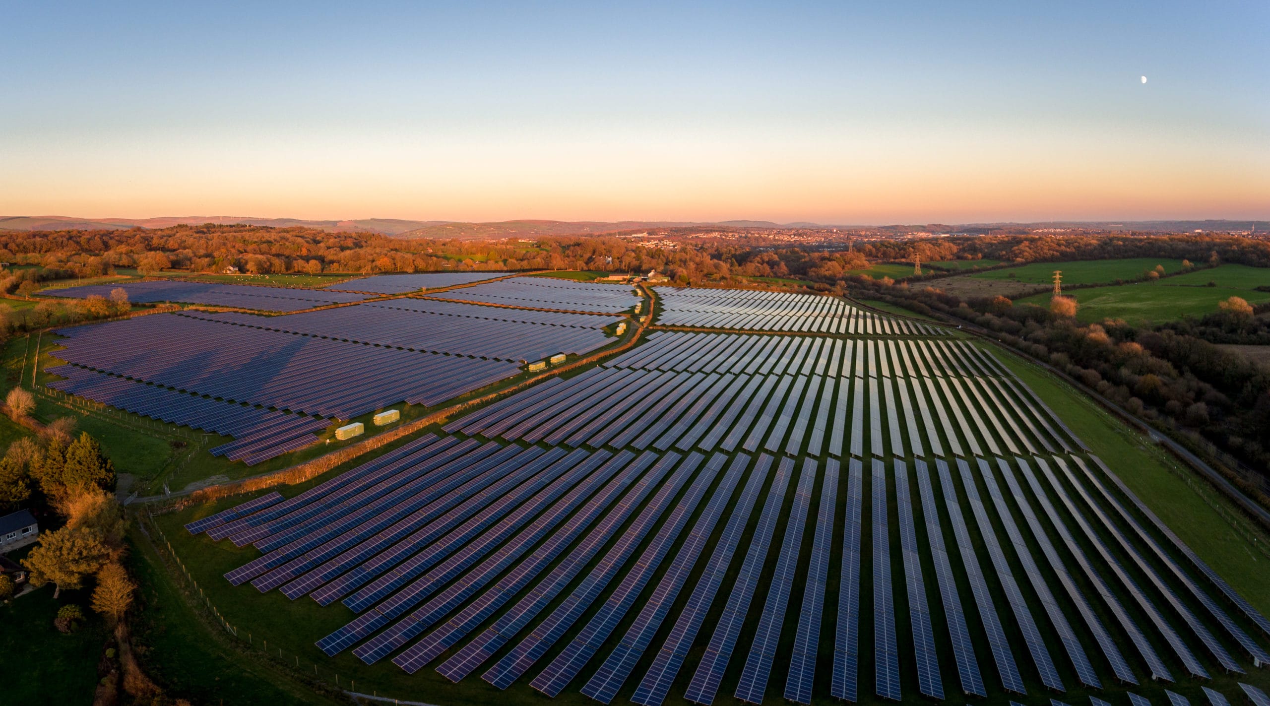
Ameresco, a leading clean technology integrator, got in touch ahead of a major renewable energy project: a 64-megawatt solar farm spread across 200 acres of open farmland. Before any construction could begin, they needed a clear, reliable survey of the entire site, both above and below ground.
The site presented several challenges. Ditches, streams, hedgerows and large mature trees crossed the land in multiple directions. The terrain sloped and changed elevation across the 200-acre footprint, and there was a general lack of reliable information on what might be buried beneath the surface. The last thing anyone wants on a project of this scale is to hit an unknown service during construction.
Ameresco needed two things: a detailed topographical survey to understand the terrain and inform panel layout design, and a full underground utility survey to identify any buried services before groundwork began.
The Scale of the Challenge
200 acres is a significant area to survey. To put it in context, that's roughly the size of 150 football pitches. Every metre of that land needed to be mapped with enough detail for the design team to make confident decisions about panel placement, access routes, cable trenching and drainage.
The topographical survey alone required capturing thousands of data points across the site. Surface features like trees, hedgerows, ditches, banks, fences and existing structures all needed plotting. And a 10-metre spot level grid across the entire footprint would give the engineers the elevation data they needed to understand drainage patterns and optimise panel angles.
On top of that, the underground utility survey had to cover the full site perimeter and all planned cable routes. On agricultural land, utility records are often incomplete or non-existent. Buried field drains, old water supplies, telecoms cables serving nearby properties and none of this is reliably documented. The only way to know for sure is to survey it.
The Challenges
The project presented a number of surveying challenges that needed careful planning and execution:
- 200 acres of open farmland with variable terrain and elevation changes
- Multiple natural obstacles: ditches, streams, hedgerows and mature trees
- Incomplete or non-existent underground utility records for the site
- Tight programme requiring efficient data capture across a large area
- Data needed to be accurate enough for detailed panel layout design
- Site access constraints during wet weather on agricultural land
Our Approach
We deployed a combined survey team with both topographical and utility detection capabilities:
- GPS and total station survey of all surface features across the full 200 acres
- 10-metre spot level grid capturing elevation data for drainage and panel design
- Boundary surveys tied to OS national grid coordinates
- GPR and electromagnetic detection along all planned cable routes and access roads
- Desktop utility records search to supplement on-site detection
- All data delivered in a single coordinated CAD dataset
Topographical Survey
We mapped the site in detail using a combination of GPS receivers and robotic total stations. Every surface feature was captured: trees, hedgerows, ditches, streams, banks, fence lines, gates, tracks, overhead cables and existing structures. The complete dataset gave the design team a true picture of what they were working with.
A 10-metre spot level grid was laid out across the full 200 acres. This captured how the land sloped and changed elevation across the site, which was essential for two reasons. First, it informed the panel layout. Solar panels need to be angled correctly relative to the ground to maximise energy generation. Second, it identified natural drainage patterns that would need to be maintained or managed during and after construction.
All survey data was referenced to Ordnance Survey national grid coordinates and levels, making it directly compatible with the engineering design software used by Ameresco's team.
Underground Utility Survey
Next, we traced any buried services across the site using a combination of Ground Penetrating Radar (GPR) and electromagnetic locating equipment. On agricultural land, this is particularly important because utility records are often incomplete, outdated or simply don't exist.
The survey turned up several underground utilities that hadn't been logged or documented anywhere. These were services that could have caused serious delays, costly damage or safety incidents if they'd been struck during cable trenching or foundation installation. Better to find them now than discover them the hard way with an excavator.
Every detected utility was plotted in the CAD dataset with depth estimates, so the design team could route cables and access roads around known services. Where detection results were ambiguous, we flagged areas for potential trial hole verification before construction.
The Results
What the survey delivered for Ameresco's project
Fewer Surprises
Previously unlogged underground services identified and mapped before any excavation.
Smoother Design
Accurate surface and elevation data gave the engineering team a solid foundation for panel layout.
Lower Risk
Detailed site data reduced construction risk and supported safer site preparation.
Time Saved
Combined topo-utility survey delivered as one dataset, avoiding duplicate site visits.
Services Used on This Project
Topographical Surveys
Detailed terrain mapping capturing contours, boundaries, levels and every site feature for planning and design. Delivered in CAD with OS coordination.
Learn more about this service →Underground Utility Surveys
GPR and electromagnetic detection of buried services to PAS 128 standard. Identifies gas, electric, water, telecoms, drainage and other utilities.
Learn more about this service →Ameresco were really pleased with the level of detail and how easy it was to work with the data we provided. It helped move the project forward quickly, and with fewer headaches than they'd expected on a site of this scale.Red Box Surveys Project Team
Need something similar?
Whether it's 200 acres of farmland or a tight urban plot, we've got the experience and equipment to deliver the survey data your project needs.
Get a quote← Back to all case studies