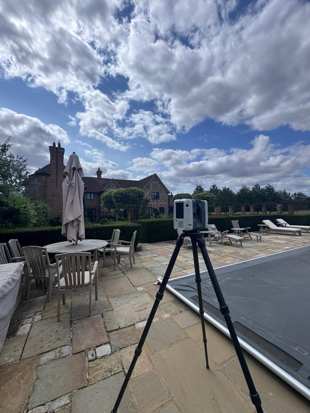
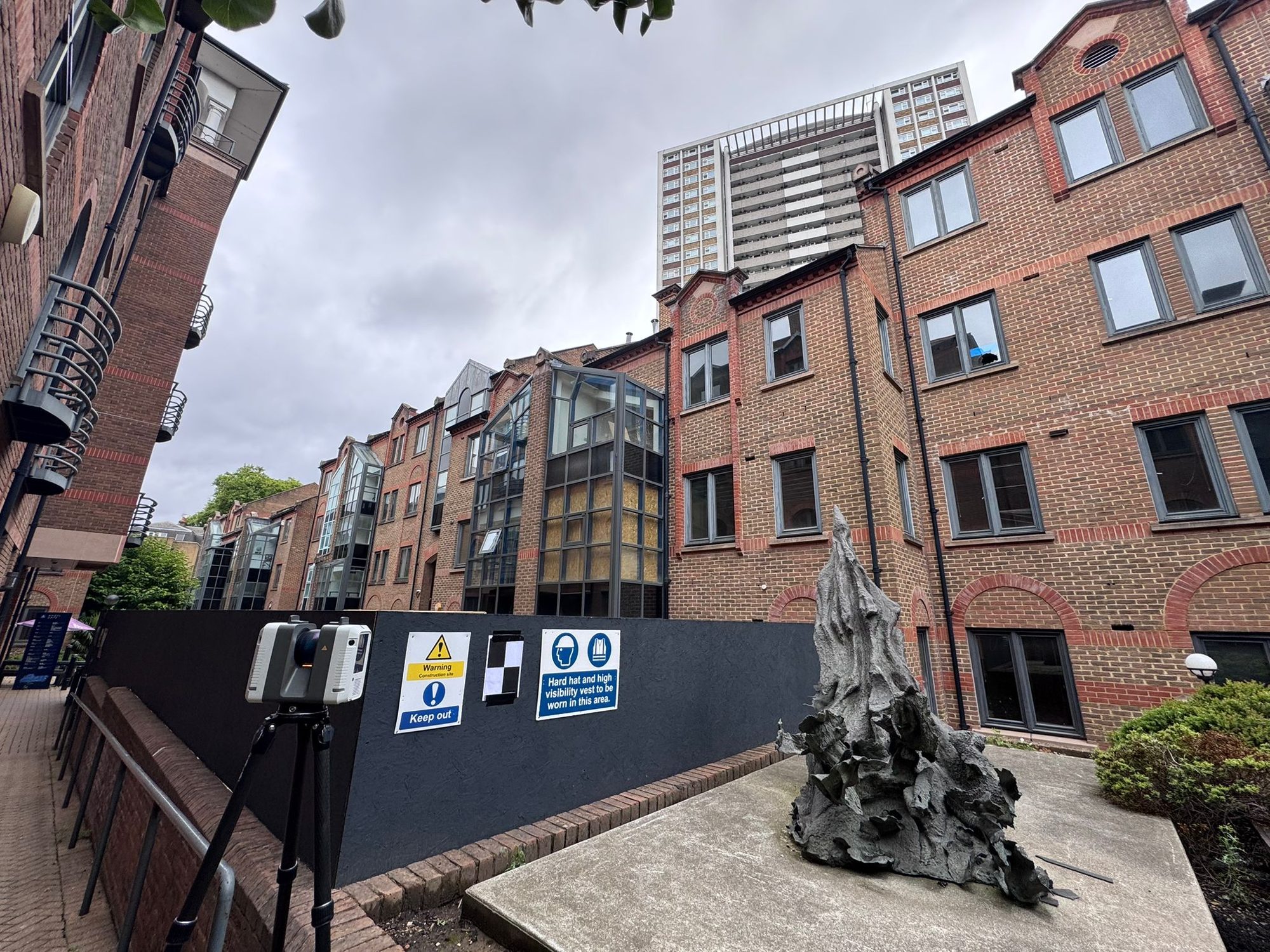
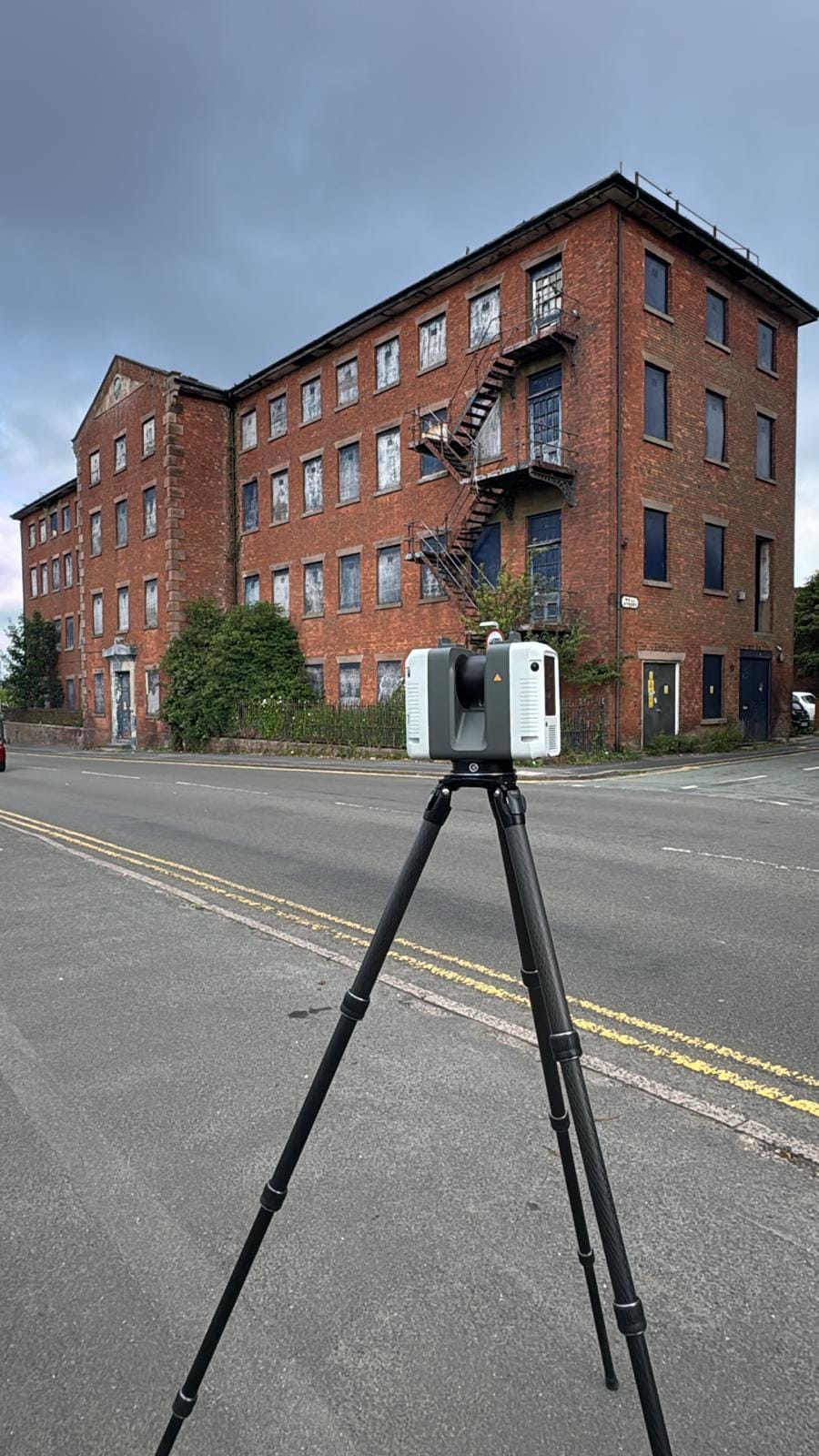
3D Laser Scanning
Our laser scanning technology delivers rapid and highly accurate high-definition surveying solutions. By capturing intricate 3D data from remote and hard-to-reach areas, we provide detailed surveys even in complex geometries, heritage sites and hazardous locations.
Get a free quote- High-definition point clouds
- 3D BIM models
- As-built documentation
- Heritage recording
- Clash detection data
- Revit/CAD outputs
- Fly-through visualisations
- Deviation analysis
High-Definition Data Capture
Laser scanning captures millions of coordinated 3D points from surfaces per second, producing detailed point cloud images ideal for mapping inaccessible areas and intricate geometries. This technology is particularly suited to heritage sites, historic buildings, facades, highways, tunnels and hazardous locations where conventional survey methods may not be feasible.
We prioritise understanding our clients’ requirements to ensure every survey is delivered accurately, on time and within budget.
Versatile Applications
Whether used as a complement to traditional survey instruments or as an alternative to total stations, our laser scanning surveys are fully customisable. Applications include:
- As-built documentation for renovation and refurbishment projects
- Heritage recording for listed buildings and conservation areas
- BIM model creation from existing buildings
- Clash detection for MEP coordination
- Deformation monitoring for structural assessment
- Forensic scanning for insurance and legal purposes
From Scan to Deliverable
Our skilled and qualified laser scanning teams have extensive experience and hold relevant certifications including CSCS cards. The process starts with careful scan planning to ensure complete coverage with minimum scan positions.
Once captured, the raw point cloud data is registered, cleaned and processed into the deliverable format you need. Whether that’s a Revit model, AutoCAD drawings, or a navigable point cloud for your design team, we deliver data that’s ready to use.
Accuracy and Reliability
Our scanners achieve accuracy to within 1-2mm at typical scanning ranges, making them ideal for projects requiring the highest levels of dimensional accuracy. The technology captures data at rates of up to 1 million points per second, allowing us to survey complex structures quickly and efficiently without disrupting building operations.
Scan Applications
Versatile technology for complex surveying challenges
As-Built Documentation
Capture existing building geometry for renovation, refurbishment and extension projects.
Heritage Recording
Non-invasive recording of listed buildings, historic structures and conservation areas.
BIM Model Creation
Revit and ArchiCAD models built from accurate point cloud data of existing structures.
Clash Detection
Identify conflicts between existing services and proposed designs before construction begins.
How We Deliver Your Survey
Consultation
We review your requirements, assess the site and provide a detailed quotation.
Site Survey
Our qualified surveyors visit the site with the latest equipment to capture accurate data.
Data Processing
Raw data is processed, quality-checked and prepared in your required format.
Delivery
Completed survey data delivered on time, with full support for any follow-up queries.
The Red Box Advantage
Calibrated Equipment
Professional-grade instruments maintained and calibrated for accurate, defensible results.
Expert Surveyors
90+ years combined experience. CSCS certified, fully insured and professionally qualified.
Fast Turnaround
Most surveys completed and delivered within 5-10 working days. Rush options available.
Fixed Pricing
Clear quotes upfront with no hidden fees. You know exactly what you pay before we start.
Fully Accredited
SSIP, CHAS, CSCS certified. Members of The Survey Association with full professional insurance.
UK-Wide Coverage
Nationwide service from our head office in Cheshire with satellite offices across the UK.
Why Choose Red Box Surveys
90+ Years Combined Experience
Our senior management team has over 90 years of surveying experience between them.
Nationwide Coverage
With satellite offices across the UK, we deliver efficient, cost-effective services wherever your project is located.
Latest Technology
We use advanced 3D laser scanning, GPS and GPR equipment to deliver precise, reliable data every time.
Frequently Asked Questions
Laser scanning uses a rotating laser to capture millions of 3D measurement points per second, creating a detailed point cloud model of the scanned environment. This data can be used to produce accurate CAD drawings, BIM models, visualisations and analysis.
Our scanners achieve accuracy to within 1-2mm at typical scanning ranges of up to 130 metres. This makes them ideal for projects requiring the highest levels of dimensional accuracy.
Scanning speed depends on the complexity and size of the subject. A single room might take 10-15 minutes to scan from multiple positions. A large building could take 1-3 days. We provide estimated timescales at the quotation stage.
We can deliver registered point cloud data (RCP/RCS/E57/LGS), AutoCAD DWG drawings, Revit models, 3D PDF visualisations, fly-through videos and deviation analysis reports. The deliverable is tailored to your project needs.
Yes. Laser scanning is non-invasive, quiet and fast. We regularly scan occupied offices, retail spaces, hospitals and schools with minimal disruption to building users.
Yes. We use multiple scan positions around the building perimeter and combine data from different angles to capture complete building exteriors, including facades and upper storeys.
See this in action
A few recent laser scanning projects.
Get a free quote
Ready to discuss your project? Fill in the form and our team will get back to you with a detailed quotation, typically within 24 hours.