TruView Walkthroughs
Interactive panoramic walkthroughs built from laser scan data, allowing you to revisit and measure scanned environments remotely. TruView turns your point cloud into a navigable visual record that anyone on your team can access from their browser.
Get a free quote- Panoramic walkthrough
- Browser-based access
- Measurement tools
- Annotation capabilities
- Markup and redlining
- Shareable project links
- Integration with point cloud
- No software installation needed
Walk through your building from your desk
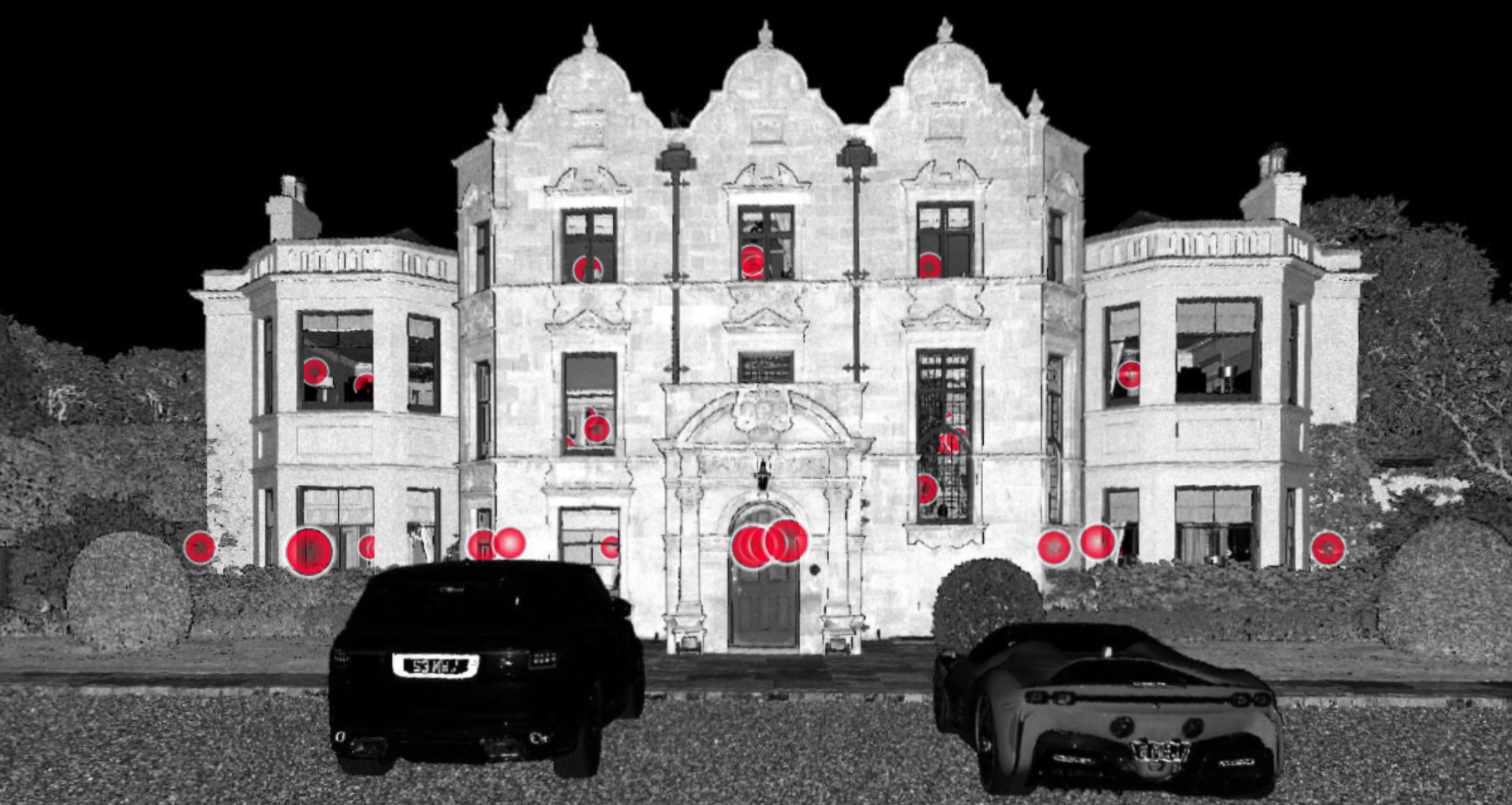
TruView takes the panoramic imagery captured by our Leica RTC360 laser scanners and presents it as an interactive walkthrough you can explore in any web browser. Click through scan positions, look around in full 360 degrees, take measurements and add annotations, all without visiting site.
It bridges the gap between raw point cloud data and something your whole team can actually use. Project managers, architects, facility managers and clients can all access the same visual record without needing specialist software or training.
How it works
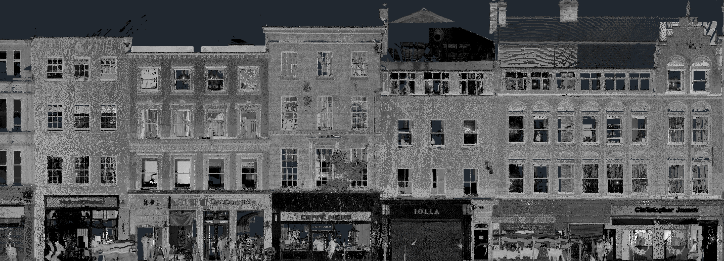
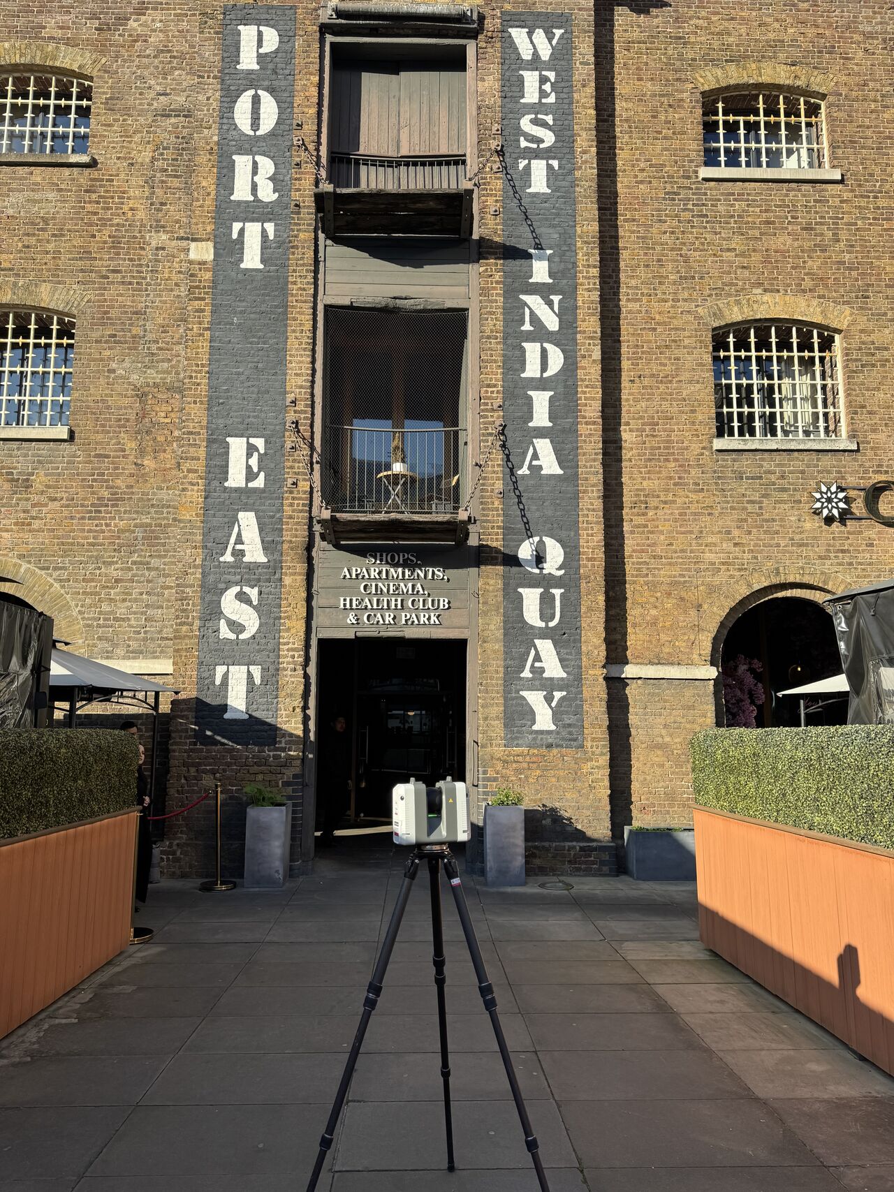
The process starts with a standard 3D laser scan of your building using the Leica RTC360. The scanner captures millions of measurement points alongside high-resolution panoramic imagery at each scan position.
Once the data is processed, the excess is trimmed out and the 3D imagery gets imported into Leica TruView. The result is a clean, navigable walkthrough where users can move between scan positions and explore the building as if they were standing in it.
TruView is hosted and shared via a simple link. No downloads, no plugins, no specialist hardware. Anyone with the link can open it in their browser and start exploring.
When TruView is the right choice
TruView works well when you need your team to access scan data without specialist software. Typical uses include:
- Remote site review for project teams who can’t always be on site
- Visual record-keeping for facilities management and asset documentation
- Sharing scan data with clients, contractors or consultants who don’t use point cloud software
- Markup and annotation during design review meetings
- Pre-construction documentation before refurbishment begins
For projects that need full point cloud processing, Revit modelling or CAD drawings, TruView works alongside those deliverables as an additional visual layer your wider team can access.
TruView features
What you get with every TruView delivery
Panoramic Walkthrough
Navigate between scan positions and explore your building in full 360-degree panoramic imagery.
Browser-Based Access
Open in any web browser. No software installation, no plugins, no specialist hardware needed.
Measurement Tools
Take measurements directly within the walkthrough, referenced to the underlying laser scan data.
Markup and Annotation
Add notes, markups and redlines directly onto the scan imagery for design review and collaboration.
How we deliver your TruView walkthrough
Laser Scan
Our surveyors capture your building using the Leica RTC360, collecting 3D data and panoramic imagery.
Data Processing
Raw scan data is registered, cleaned and the panoramic imagery is prepared for TruView.
TruView Build
Processed data is imported into TruView and configured as a navigable walkthrough.
Delivery
You receive a shareable link to your TruView walkthrough alongside any other scan deliverables.
The Red Box advantage
Survey-Grade Data
TruView is built from Leica RTC360 laser scan data, not consumer cameras. The measurements are real.
Expert Surveyors
90+ years combined experience. CSCS certified, fully insured and professionally qualified.
Fast Turnaround
TruView is typically delivered alongside your other scan outputs within 5-10 working days.
Fixed Pricing
Clear quotes upfront with no hidden fees. TruView is priced as an add-on to your scanning project.
Fully Accredited
SSIP, CHAS, CSCS certified. Members of The Survey Association with full professional insurance.
UK-Wide Coverage
Nationwide service from our head office in Cheshire.
Why Choose Red Box Surveys
90+ Years Combined Experience
Our senior management team brings over 90 years of surveying experience, ensuring every project meets the highest standards.
Nationwide Coverage
With satellite offices across the UK, we deliver efficient, cost-effective services wherever your project is located.
Latest Technology
We use advanced 3D laser scanning, GPS and GPR equipment to deliver precise, reliable data every time.
Frequently Asked Questions
TruView is Leica Geosystems' browser-based viewer for laser scan data. It presents panoramic imagery from scan positions as an interactive walkthrough with built-in measurement and annotation tools. No specialist software is needed to view it.
TruView is built from laser scan data captured by survey-grade instruments like the Leica RTC360, so it sits alongside your point cloud and CAD deliverables. Matterport is a standalone visual tool aimed at property marketing. TruView is for teams already working with scan data who need an accessible way to share and review it.
Yes. TruView includes measurement tools that reference the underlying scan data. Measurements are based on the same laser scan points used for your CAD and BIM deliverables.
No. TruView runs in any modern web browser. We send you a link and you open it. Works on desktops, laptops and tablets.
TruView can be added to any laser scanning project as an additional deliverable. Talk to us at the quotation stage and we will include it in the scope.
Get a free quote
Ready to discuss your project? Fill in the form and our team will get back to you with a detailed quotation, typically within 24 hours.